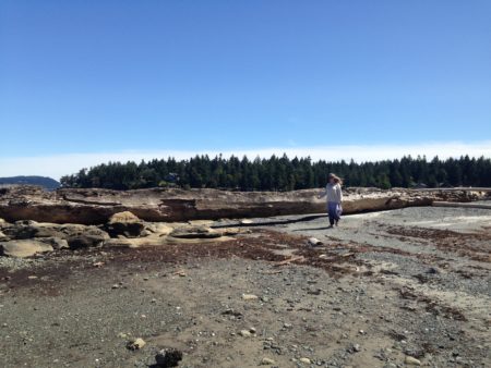
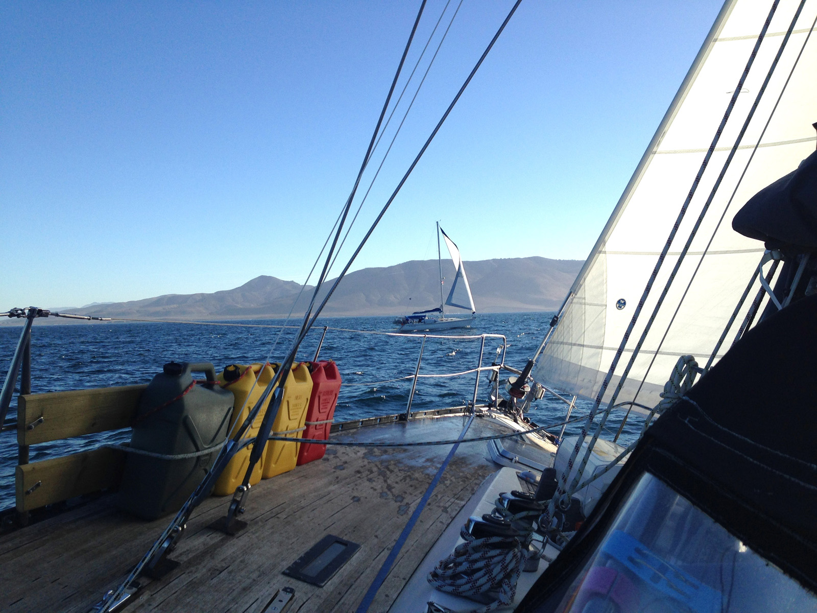
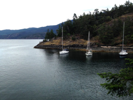
We decided to spend our last few days at anchor in Nanaimo Harbour, which has become one of our favourite places. It has good holding, nearby hiking, washrooms with showers on Newcastle Island, access to groceries, booze and boat parts wishing easy walking distance and is a great place to simply sit and people watch. The weather turned out to be glorious and we enjoyed the warm sun and ran errands without thinking too much about the next week.
Over the next couple of days we had a visit with Leslie’s parents, enjoyed a beer/cider with an old high school chum (Hi Katie!), filled the propane tanks and hike some new trails on Newcastle Island. But all too soon it was Sunday morning and time to move onto the next phase.
Get Trucking
In the meantime however, we did need to make plans to move off the boat. We had no vehicle in British Columbia and I had sold my truck in January. Flying home to get Leslie’s car and driving it back would have cost too much and the and the little Pontiac likely wouldn’t hold all our stuff anyway. The next option we looked at was flying home and shipping the rest of our stuff. This was my referred solution. But I looked at the cost of flights out of Vancouver (we try to fly by seaplane to YVR and then home on Westjet or Air Canada, as it usually saves time and costs roughly the same as a taxi ride to Nanaimo’s airport and a direct flight) and then started to add in the extras. Shipping our stuff by truck wasn’t too much but it would mean I had to find a pallet and boxes and packing material and then get the all stuff to a depot. Total cost of around $1200. Another option I looked at was to leave a lot more stuff in storage and just ship 3 big boxes via Loomis — they would pick up and deliver. But the cost was pretty much the same and we would have ended up leaving behind way too much stuff that I wanted to take home.
Then we looked at booking a van one-way. The rental from a traditional rental agency was going to be at least $1100. A U-Haul was more like $500 but then I had to drive a big, half-empty cube van across the Coquihalla and pay for all that fuel. Not my referred option. In the end, we settled on renting a full size car which would likely fit most of our stuff if we crammed, and only cost around $800 all-in. With ferry, meals and a hotel half-way that worked out to around $1200. Roughly the same cost as all the other options and Leslie’s preferred solution. As I was booking the car though, I discovered my license had expired back in April (Alberta decided to stop mailing out notices while we were away) so it looked like Leslie was going to have to drive — another good reason not to go with the U-Haul.
Up Anchor for the Last Time
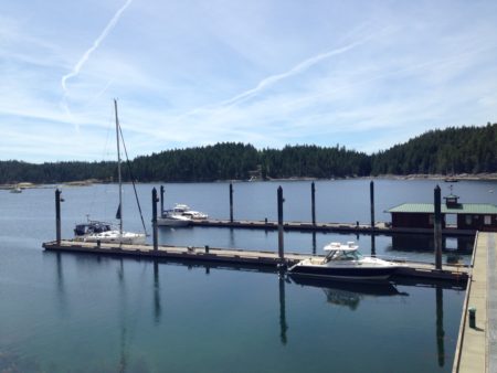
On Sunday morning we hauled up the anchor and headed into the pumpout to give the holding tank a good flush. For once it worked—we’ve had a lot of bad luck with the Port of Nanaimo’s pumpout. We pumped it out, flushed and pumped it out again. Then we cast of and headed to the Gas and Go right by Stones Marina to fuel up. Once we had topped off all the tanks, Ian from Nanaimo Yacht Charters and Sailing School met us on the fuel dock and directed us into one of their slips at Stones and that was that. It was time to start getting ready to go.
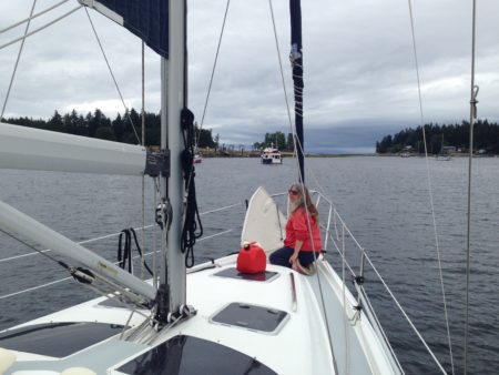
On the bow the last time for a least a year.
As soon as we hit the dock we started by dividing the boat into three zones. The v-berth became the place for things returning Edmonton. The salon housed things going into storage and lockers were strictly for things remaining aboard.
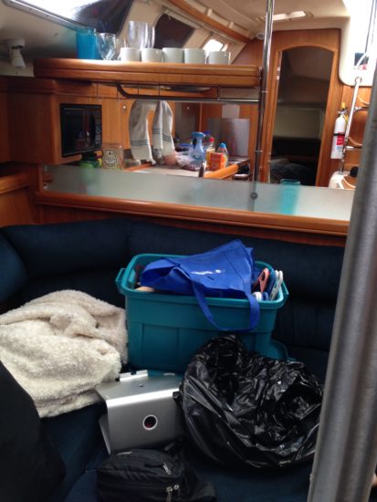 In less than an hour the boat was a disaster area and remained that way until the very last minute. After nearly a year of an orderly and tidy boat it didn’t take long for us to start losing, misplacing and more importantly, miscommunicating, about everything we owned. Living in such a small place for so long relies on consistency and cooperation and once we started disassembling our little world, it didn’t take long for the clutter and the differences in our methodologies to create havoc.
But we had many, many reviews and reconsultations and the occasional moderate dispute and we kept moving forward. Step by step we made slow progress using what I like to call the box-step method. Two steps forward, one step sideways, one step back. Repeat. We tried to make lists of everything we packed and to make sure things were labeled so that we weren’t going to be sitting in Edmonton wondering where things had got to or if we needed to bring it out with us on our next trip. And while we didn’t expect to actually clean the boat to “charter” status, I wanted to get it unloaded, cleaned up a bit and then get at a few things I hadn’t been able to do in the spring. This included scrubbing the outside lockers, cleaning some hard-to-get-at spaces and rewaterproofing the canvas
Keeping it Clean
Keeping a boat clean while living on it is a test of skill, ingenuity and good systems. And I have to admit, we seemed to have failed. Most of the things I had scrubbed in the spring, inside and out, were even dirtier than after the winter and the things I hadn’t scrubbed were downright disgusting. The aft locker especially was a mess. I hadn’t done it because it was hard to get at on our old dock and frankly it was crammed full of so much stuff that I kept putting it off. But since we were tied stern to at Stones I had no more excuses. Out came everything and then down I went. The locker is a bout 2 and a half feet deep with and opening wide enough for more torso but not wide enough for my shoulders to easily pass through. By slipping one arm and then the other in I could hand from the waist and almost reach every corner of the dirty, mildewy locker. But getting out again was an exercise in controlling my mild claustrophobia as the leverage was just not there. But I got it cleaned out and all the junk was sorted and then the stuff that was staying aboard was restowed. Ian agreed to take my old plough anchor on consignment so was one issue I didn’t have to deal with.

The non-skid was another thing that seemed to collect dirt and grime at an excessive rate. I had scrubbed it all back in March April but it seems to get much dirtier, much faster when we are cruising. I tried a number of products from regular deck soap to special “corrosive” noon-skid cleaner but my best results were by using liberal amounts of FSR (fibreglass stain remover) and letting it soak in. Amazing stuff, that FSR. I also smeared it all over the small rust bits on the stainless plate mounted under our arch and it cleaned up all the rust in all the crevices and corners.
Over the course of the next few days we scrubbed the canvas again, although the rain later in the week prevented us from waterproofing more than than the dodger and connector. We cleaned out the fridge again (another thing really hard to keep clean when living aboard) and dug as much accumulated grunge out of the seemingly infinite crack and crevices that exist in a boats interior.
Although we had tried to keep up with the mildew over the winter and spring, as soon as we started unloading our stuff it became apparent that there were a lot of places (mostly the aforementioned cracks and crevices) where mildew had taken hold. I am not sure how one would deal with this long term other than to constantly shuffle ones belongings from space to space and cleaning as you went. But that would mean always having an empty space available to shuffle things to and that’s not really feasible.
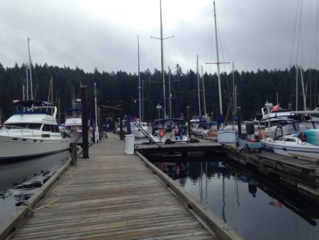
Nanaimo Yacht Charters and Sailing School
 I’ll do a separate post later on the wrap up of turning the boat over to NYCSS but Ian, Lorraine and Shari were their usual friendly and helpful selves, offering us use of their car and access to all the services. We discussed the repairs the boat needed (the d@mned Webasto heater stopped working sometime in the last 2 months among other things) and cleared up some details. On Tuesday we did the haul-out, pressure washed the bottom and replaced the zincs. The zincs were mostly gone and I really should have replaced them much earlier. But other than that everything looked good.
 I had a chance to chat with the owner of Stargazer who was just returning from his cruise. He has had his boat at NYCSS for a couple of years now and was happy with the arrangement, which just reinforced our decision to give it a try. He said one of his deciding factors when choosing Nanaimo was their integration of a boatyard, service people and haul-out. Since everything gets billed back to the owners I can see how not having to pay the extra costs involved in moving the boat to a separate location for any work would be desirable.
We also met Selma, who is one of the local liveaboards’ cat and a bold and bossy little girl. But it was nice to get a little cat love again.
NYCSS also provided us with locker space on site (at a cost of course — tanstaafl), which was a great bonus for us during the week. We slowly hauled out everything that made the boat our comfortable home up and stored it in big, labeled rubbermaid containers. That way, when we come back we can just move what is appropriate for the length of our cruise. The charters are called bare boat and they mean bare boat. We were provided with a list of gear that needed to be aboard and they really didn’t want any extra things like the percolator or dutch oven unless we were willing to bear the risk of loss or damage. So we packed it all up and moved it ashore so we would have it for our own use later.
We stored things like our nav equipment, charts, and pfds as wells as sheets, comforters and pillows—Leslie even left a bunch of clothes. There was also lots of extra galley gear, some reference books and cleaning stuff. All in all, there was a lot more than I thought there would be.
Saying Goodbye
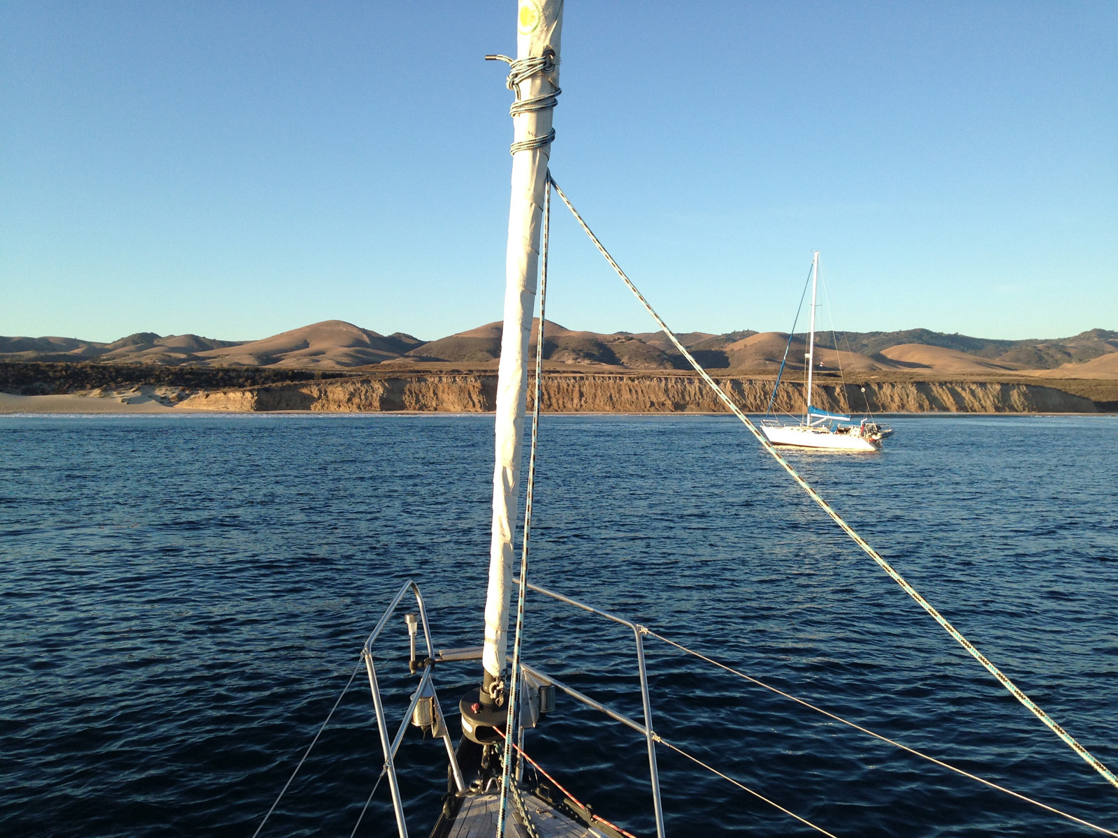
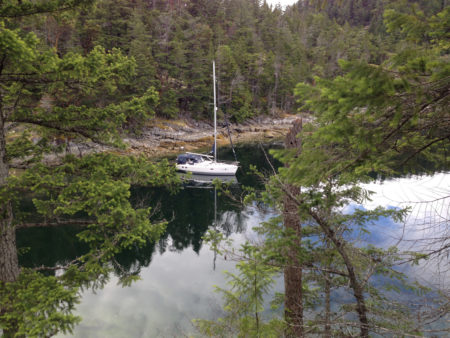
Our last view of Never for Ever for 2016.
We didn’t get it all done. It was too much, having to sort, move and clean at once and when we finally stepped off the boat on Thursday morning it was still a mess. But they have over a week to work on it and were going to go over it bow to stern anyway. All the cushions were going to be steam cleaned, bilges scrubbed and all the surfaces and lockers cleaned out by their experienced and well-equipped crew so I didn’t feel too bad about leaving it half done. We’d worked hard all week and it was time to go.
Thursday morning we packed up our last bits, stuffed the sheets in a laundry bag, hauled the pillows up to the storage locker and walked through the boat looking for forgotten items. Then we walked the keys over to the office, said goodbye and jumped in the car.
And like that our adventure was over.

Back to the old way of getting around.
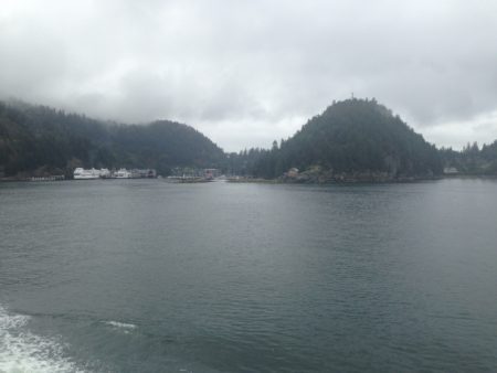
Horsehoe Bay from the ferry. The last view of salt water for a while.
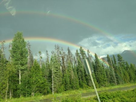
We were greeted with a lovely double rainbow just outside Valemount


 The Trip


 I had phoned ahead and they had a spot for us at the marina so I had also texted my friend Darryl and enquired if he had some free time. He invited us to his house for dinner and some wine and we gratefully accepted. Once we hit the dock we cleaned up and relaxed while we awaited our ride. Darryl and his wife Loretta had just moved from the Edmonton area the year before and had been fixing up a lovely A-frame on the hill overlooking the Strait. Lovely place. We ate, drank and visited until it was time to head back to the boat. It’s a nice area and one well worth considering if you want to move to the coast.


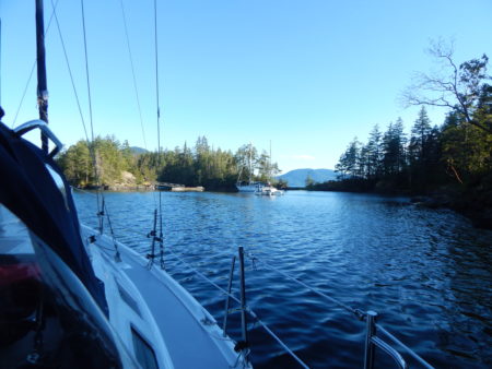
 So as we hung on the hook in Von Donop Inlet, one of our tasks was to finalize the revisions to the official charter manual. This manual includes all the standard charter info and then details the systems on our particular boat, as well as documenting any how-to’s or processes we deem necessary for safe, fun and easy use by people who will be aboard for as little as a week. It is an amazing exercise to think through all the systems and steps and then try and record them in a coherent and orderly manner. I found it particularly fascinating to uncover all the small routines that we had internalized and reexamine some of the unconscious habits we had gained. While for most owners it would be a lot of work for little gain, I would almost want to suggest that everyone go through the exercise. Certainly if you were selling your boat it would be an massive boon to the buyer. Take a look at the end of this post to see the Table of Contents as it stands now.